City Preparedness Monitoring and Emergency Response
REACT
Context
In the last 20 years, disasters have affected about 440 crore people in India causing over 13 lakh deaths and incurring about 6 lakh crores in loss. Despite having strong early warning systems and various disaster management plans and policies in place, it is still strenuous for the Indian Administration to minimize human, animal and infrastructural losses. Various studies also prove that globally, about 83% of cities are at high mortality risk and nearly 89% of cities are highly vulnerable to economic losses from at least one type of natural disasters (Gajjar 2013). India with its varied topography and strategic location has been witnessing a variety of disasters from earthquakes to climatic events like droughts, flash floods, cyclones, avalanches, landslides etc. brought in by torrential rains and snowstorms causing massive losses to life and property. In addition, anthropogenic events like chemical accidents, fire and disease breakouts too have been posing greatest threats. Compounded by an increasingly adverse climate change, the frequency, intensity and unpredictability of the occurrence of these hazards have risen exponentially.
Since the inception and adoption of the Hyogo framework of action in the year 2000 (UNISDR, 2005) and the more recent, Sendai framework of action in 2015, the rapid growth, unplanned urbanization, irregular planning of spaces and a growing deficit in infrastructure in cities is leading to the creation of risk, largely occurring in the context of widespread poverty. Cities are today representing the greatest concentration of people and economic activities are seen to overlap with areas of high-risk. Numerous current urban planning and development discourses drive vulnerability, including the fact that disaster risk is rarely taken into account in real-estate investment decisions. To this extent, the social segregation caused by the uneven urban development discourses of our country often result in unequal or lack of access to urban spaces, services, infrastructure and social security to the low-income groups making them vulnerable to social, economic, physical and technological risks.
Problem Statement
The approach to disaster management in India has been largely response and rehabilitation centric as opposed to being risk-reductive and resilience inducing. Additionally, it was also recognized that the most vulnerable that are the most affected and it is them who are often not accounted for when risk assessments are conducted. This finding is further substantiated by a working paper by UNDP and IIHS, which highlights the same.The present static scenario of disaster management needs to be addressed and shifted to a dynamic one, where: Data pertaining to previous disasters and its impacts are updated periodically and shared, rather than being in silos. The scale of analysis is shifted from a macro to a micro one, which could further contribute to a targeted emergency response. And above all, the enormous scope that digitisation presents to any sector, should be tapped into.Increased emphasis on disaster resilience requires emergency practitioners to shift focus from a top-down ‘command and control’ model to one more strategic, participatory, and dialogic with communities and stakeholders; where value is increasingly recognized in both authoritative and citizen information and practices. This has led to a focus on implementing initiatives cantered on community engagement and innovations in information and communication technologies that can empower citizens in disaster response.The theoretical and practical perspectives addressed in the premise have helped in identifying three particular gaps the current disaster management scenario of the country has, that we intend to help solve: A lack of micro-level disaster risk mapping and information dissemination platforms and planning for resilience in policy.; Non-compliance to citizen-centric disaster management methods; Non-availability of a single web-based crowdsourced platform to manage emergencies of all kind.
Objective
While the intent of the project is to develop a citizen-centric digital platform for automated risk communication and resilience assessment for efficient and targeted emergency response, the project sets out the following objectives to achieve the same: To analyse Disaster Risk at a micro level within the city.
- Develop a citizen-centric, Community Resilience Index for clusters identified as lying-in high-risk zones.
- To analyse/establish correlation between Risk and Resilience Indices of the identified clusters.
- Develop Emergency Response Mechanisms based on the correlated output.
The web-based solution targets providing a holistic view of disaster risks as well as the resilience of the city. The project as well as the tool aims to integrate the indicators of risk and resilience spatially to arrive at a final correlated score. The spatiality of the product adds to its value as it lets the user take a closer look at each unit within the city not only to pre-position the city’s emergency response but also to be able to identify the short-term and long-term interventions required to be taken in order to minimise the adverse impacts of the disaster. So, to conclude, the proposed research concentrates on comprehending, analysing and deciphering both the current disaster management scenario and the extent of its citizen centrism.
Project Strategy
Pilot City Identification
During the ideation period, a number of smart cities were identified with posing potential threats of natural as well as man-made disasters. A list of 24 smart cities were identified with potential threats and scope to work on city level disaster management. To finalise the city for the pilot each city was categorised under certain parameters like AMPLIFI Portal Data (a data portal Under Ministry of Housing and Urban Affairs currently collating data of 118 cities across the country), City Disaster Profiles, the Pandemic Scenario, Ease of Access from New Delhi, Presence of Integrated Command & Control Centre (ICCC) etc. Each city was given a score by using the Analytical Hierarchy Process (AHP) and initially 15 cities scored more than 0.6 using the AHP and Shimla had the highest score. Hence Shimla was chosen to pilot the project.
Shimla city is highly prone to disasters. The city falls in the earthquake zone 4 and is highly susceptible to earthquakes. The city is also highly vulnerable to landslides which originate due to tectonic movement or heavy rainfall during monsoons followed by mudflow. Additionally, the city is also prone to land sinking, flash flooding, hail storms, storms, accidents, and both forest and urban household fires as well.
Project Development and Implementation

Expected Outcomes
With the project aiming to provide digital and information technology-based solutions to pressing citizen-centric inclusion-based issues, the outcome of the project will be two-fold.
- A digital (web) based platform containing mapping-based information pertaining to risk and community resilience assessment at a micro level for information dissemination to the various stakeholders involved in disaster management and especially to the citizens of the city.
- This platform would also include information pertaining to evacuation shelters and routes, contacts of resource personnel, health centres etc based on accessibility patterns. This could be used by the administration to address daily shocks or plan long-term disaster mitigation strategies.
Actual Result
While the initial idea behind the project was to conduct the analysis at a micro-level, due to temporal challenges, duration of data collection and lack-of interdepartmental coordination, micro-zonation could not be taken up in this phase and will be taken up in phase 2 of the project where it will be combined with the ongoing micro-mapping project of the city. Due to the unavailability of the updated 34 word map of Shimla, we have used the map that was made available to us by the administration consisting of 25 words. Also, due to the lack of opportunity for us to officially pilot on the ground and present the project to the stakeholders, the weights - subject to the perception of the team and the subsequent scores derived - have not been validated as yet with the stakeholders. Additionally, due to the non-availability of a benchmarking/standardised system to categorise low medium and high risk, we have referred to available literature to derive our methodology for analysis and thereby the scores and the division/categorisation of risk. The aspect of community engagement with those living in the bottle-neck regions has been pushed to phase 2 of the project due to temporal issues.
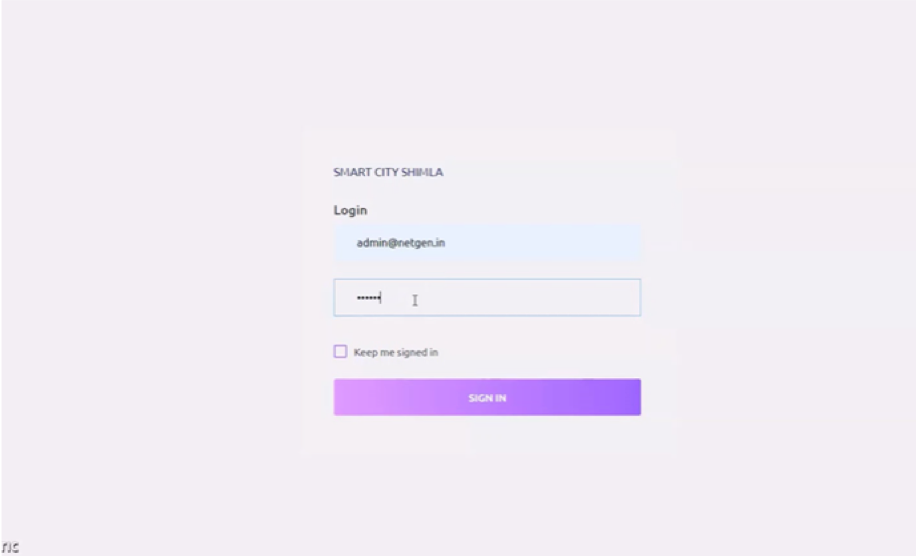
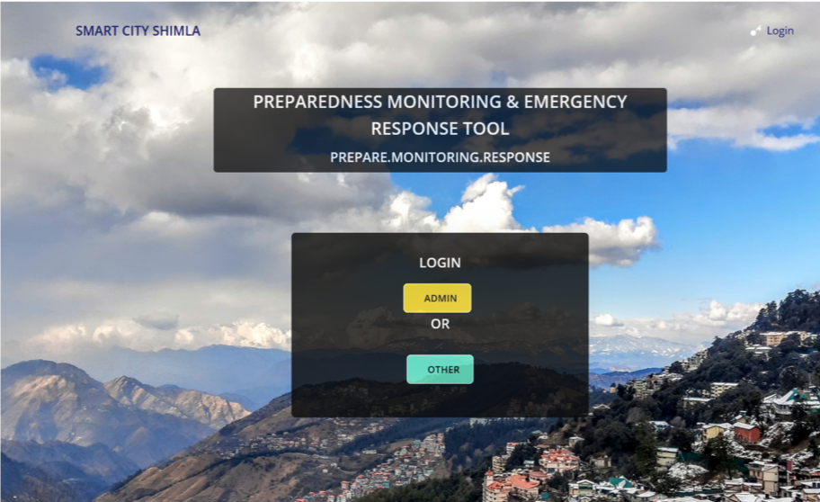
On the landing page of the dashboard, there are two options - admin login/others, where the admin option belongs to the city administrators/the decision makers and the other option belongs to the responders. Once the admin logs in using his/her credentials, one can view the select city or word option.
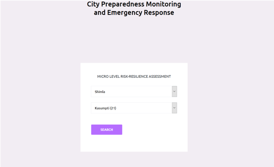
Click on search option, once the ward the admin wants to see is selected.

Once you click on the search option, the administrative details of the ward, along with options to view the hazard, vulnerability, risk and resilience profiles, are available. Upon choosing any of the options, a new window will appear with information pertaining to that particular choice option, w.r.t., to the selected ward.

After selecting the resilience profile, the rank of the ward in the city, and the resilience score along with, the parameters used for calculation will be shown and classified based on low, medium, and high levels. Similarly, hazard, vulnerability and risk profiles will be shown along with the parameters considered for analysis
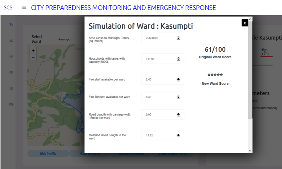
Upon selecting any of the Recalculate Score Tabs, a second part of the portal will open up where the user can re-evaluate the score.

By increasing the values of the parameters taken into consideration for calculation of the resilience profile of the ward, the user can re-evaluate the score of the ward and understand the impact of each parameter on the profile.
Conclusion
The product, currently focusing on urban fire hazards at a ward/meso level, can be scaled down to the neighbourhood level or scaled up to the district/state level across the country. The product is now limited to city administration, which is divided into decision-makers and responders, but can further be developed into a quadruple-helix model, including citizens, their perception, and the dos and don’ts during a disaster. This product, with minor context-specific tweaks to the parameters according to the hazard, can be replicated across different communities, hazards, and across geographies. The second phase of the portal would focus on involving citizens at various levels for, crowdsourcing data, grievance redressal, and risk, and resilience information sharing in order to increase their preparedness. The team will also partner with the local NGO, DOERS, who are currently in the process of developing a Fire Hazard Plan for the city and integrating the city disaster plan and the fire plan with the product. Further In order to access the current infrastructure provisions in the identified bottleneck regions with respect to the specially-abled and chart out a plan of action with the NGOs. Also, to include citizens and their perceptions of risk and resilience, it is visioned to develop an interface for the citizens which can act as a reporting and crowdsourcing platform for urban fire hazards which are key indicators of participative, citizen-centric and Smart City planning. To scale the product to various frequently occurring hazards in the city and thereby to the state under the guidance of Mr. Rajneesh, Under-secretary, UDD, Shimla.